Saturday, April 13, 2013

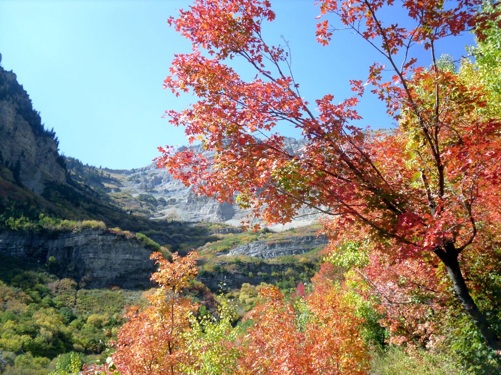
Mountain of the Lord

This time of year it's always hard to figure out where to hike. In the late summer and early fall you can pretty much go anywhere you want and it's accessible and beautiful. This time of year you have to worry about snow on the ground, snow falling from the sky, rain, mud, daylight, and temperature. I like to stay low in elevation this time of year to avoid most of those potential problems.

The main purpose of today's hike was to load up my backpack with everything I would need for a night in the mountains to see if I could carry it all. I decided to start out with a pretty flat hike, so today I decided to try out the Bonneville Shoreline Trail.

Yes, there's a lot of Bonneville Shoreline Trail all over the place. It's in scattered pieces across, well, anywhere Lake Bonneville used to be. Since I also wanted to stay close to home I did a portion of the trail from Hidden Valley Park in Sandy to the LDS Temple in Draper.
I always imagined this portion of the BST to be flat, wide, and extremely boring. I was completely wrong on all counts, and this became one of my favorite hikes so far (I probably say that about every hike I do).
The trail goes up and down, weaves back and forth, crosses rivers and streams (okay, just streams). And not only was the path of the trail much more interesting than I thought it would be, but the trail is very well maintained. There were bridges over every stream and everywhere a stream could possibly form.
There were a lot of small canyons along the way. At these points the trail would usually drop down a bit to a bridge, then head back up. Sometimes it was pretty steep on one or both sides, and I felt a little bad for the mountain bikers I passed. They probably enjoy steep trails like that though.
A couple miles into the hike I started up the wrong trail. The trail climbed steeply for a bit to get over a ridge and another trail (the Trail of the Eagle) continued up the mountain, while the BST went through a small rocky patch then headed down. I took the Trail of the Eagle for about 1/8 of a mile before I woke up and wondered why I was so high up the mountain. It was a great view and all, but I had places to be. As I backtracked I cursed the trail designers for not marking the intersection better... Until I got back to the intersection and saw a very clear sign I didn't even see before, even though it didn't seem possible to miss it.
In the middle of the hike there were a lot of good places to sit, like this rock.
For some reason I kept getting rocks in my shoes. I almost never get rocks in my shoes, at least not like this. Every time I took off my shoes to empty them I'd get another rock within just a few feet. My shoes also kept coming untied. It was pretty aggravating, but what can you do?

Almost 3 miles in (or something like that--I don't remember) I caught my first glimpse of the temple. It looked a lot bigger and closer than it does in this picture.
One other "new" thing I did on this hike was to walk the trail from one point to another rather than walking in, then walking back. Fortunately Annie was a really good sport and agreed to pick me up at the end and take me back to my car.

First, an apology for the quality of these pictures. My "hiking camera" barely works. The screen went out on it sometime last year so I can't see the pictures until I get home. I usually take 2 or 3 pictures of everything to try to make sure at least one comes out. The picture below definitely did not come out, but I wanted to point something out in it.

It's hard to see, but there's a little lock box to the left of the bridge. I believe it's a wildlife camera. There were picture of animals attached to the bridge that the camera had taken. It was pretty cool to see. I wonder if that means there's a picture of me too?
The temple got closer and closer. It was a little weird that it was still so far away.
There were more bridges. It was really nice to have the bridges. It would have been nicer if there had been a lot of water for the bridges to bridge, but nice anyway.
I think this bridge was in the Corner Canyon area. I'll definitely have to return to Corner Canyon. This was my first time there (that I remember).
Finally, after 2 hours, 5 miles, a total elevation gain of 1,200' (overall elevation gain of 36'), and an extra 20 pounds on my back, I arrived at the Draper temple just a few minutes before Annie did. My early arrival allowed me time to empty the stupid rocks out of my shoes again. It was a great hike; one that I will definitely do again.


Saturday, March 30, 2013

Bells Canyon - The Other Way

Wow. Two hikes in two days. This year is starting off great!

Annie was meeting some people for lunch (and taking Sydney along) so that left Titan and I free to hit the hills. We decided to head up Bell(s) Canyon, just to the lower reservoir. Last year we went up as a family on Memorial Day, along with everyone else in the valley. This year there weren't nearly as many people, but it was still a pretty popular place to be.

Last year we started at the mouth of Little Cottonwood Canyon and hiked up from there. This year we parked at the parking lot on Wasatch Blvd (that I had seen last night trying to find the lot for Rocky Mouth). It was a very different trail. I'm not sure which I preferred.

Wait, yes I am. I preferred the Little Cottonwood trail. This one was very steep in places and there were a few places where it was really hard to keep your footing. I saw multiple people slip and fall.
There was a particularly difficult spot where my water bottle popped out of the pack and bounced thirty feet down the nearly vertical trail. Fortunately there were some nice people behind me that brought it back up to me.

Titan did fantastic in the carrier. He didn't have any freak-outs like last year. We talked most of the way up and down. He thinks that every body of water is a "tubby", and would point out all the tubbies he saw. He was also excited to see the little patches of snow here and there.
I look really worn out in the above picture, which is funny because that was taken after our 20 minute rest at the top just before we headed back down.

I think the trail was about as long as the Little Cottonwood trail; right about .75 miles, give or take a mile. The water level was really low, but it was a great little hike. I think Titan especially enjoyed it. He loves to be outside.
We drank some gatorade (Titan drank from his sippy cup) and ate some Clif bars at the lake. We rested about 20 minutes, I gave directions to a surprising number of people coming up the trail (good thing I know my way around), and we headed back down to the car.
It was another beautiful day for a short hike, even if I had an extra 35 pounds to carry (Titan's a LOT heavier than last year). I'd recommend a trip up to Bells Canyon Reservoir to anyone; I'd just recommend going up the other way.

Rocky Mouth Waterfall

It's March and I was able to get out and do a little hiking. It was a beautiful day for a hike and I had no other obligations so I decided to take my son up to the Rocky Mouth waterfall.

I'd heard about the hike a lot, and had wanted to go for a long time. It's still a little early in the year for there to be much water falling, but that was just perfect with a not-quite-two-year-old.
The trail starts at about 11300 South Wasatch Blvd in Sandy. There's a little parking lot (really little, in fact) and a wooden stairway that leads from there toward the mountain. Then, after climbing 100' or so you come out into a neighborhood. Really. Just like that. And there are no signs or anything telling you where to go.

I figured it was probably best to continue going uphill, and sure enough I found where the trail continues up around a curve in the road.

Being an impromptu sort of hiking excursion I didn't have a way to carry Titan. Well, just in my arms or on my shoulders (he hasn't figured out the whole hold-on-to-dad's-head-so-I-don't-fall-off thing, so I had to hold him on there. He walked quite a bit of the trail, but wasn't able to get over the big steps (and he gets distracted really easily. I'm pretty sure he pointed out every leaf and rock.)
The trail is pretty short. It's probably not even a half mile from the parking lot to get to the waterfall. It's also not very steep. I think I read that there's an elevation gain of about 280', which isn't too bad over 1/2 mile.

The trail goes in between a couple houses, which is a little odd but it works, and the waterfall isn't too far beyond the back fence of the houses. It's a really pretty area. I'd like to head back when the trees have leaves and there's more water falling.
Just short of the waterfall there's a cemented-shut mine entrance. The tunnel goes into the mountain a little bit before the cement wall, so it sort of still looks like a tunnel. Titan kept saying "tunnel" and "train", I guess expecting a train to come roaring out of the tunnel any time.
The waterfall is one of the prettiest you'll find so close to the valley. I imagine it looks better with more water, but it was nice to be able to get up close to it without worrying about it carrying Titan down the mountain.
The hike was about a mile round-trip, and took us less than an hour. In fact, it almost took longer to find Wasatch Blvd than it did to hike the hike. It was a great first hike for the year.

This would be a great hike for families with young kids. It's not too steep, you're not walking on the edge of any cliffs, and there are plenty of rocks and leaves to keep the kids interested the whole way.


Monday, December 31, 2012

2012 Hiking Summary

It has been a great summer. Not only was I able to hike 15 times this year, I also got a new job and we moved from Tooele to Riverton. Titan is a year older and so much more fun now that he can move around and communicate. It was great to be able to take Annie and Titan on some of my hiking adventures this year, and I have to thank them both for letting me get out of the house and hike all over the place. I tried to plan the hikes at times when I wouldn't be missed, but I'm sure I still missed out on some time that I could have been with them.

I've compiled a list of all my hikes along with links to the blog post about each one. There are two hikes that Annie blogged for us, and one that was blogged by the HAM radio group I hiked with. I also added how many miles I hiked on each trip. If you're a very quick adder, you'll notice that I hiked a total of 98.34 miles this summer. That's an average of 6.56 miles per hike. Not too bad, really. There's a really good chance I'll sneak in another hike this year just to get over 100 miles. (If I was ten miles short I wouldn't bother, but 1 1/2 miles? Come on.) EDIT: Check out below! I did another hike!

My friend Tyler got me going this year, and I really appreciate his enthusiasm and knowledge. Hopefully next year we'll be able to hike together more often. We climbed Frary Peak together in March while we were still waiting for the snow to melt off the higher peaks.


After Frary, I wanted to hike somewhere flattish, but long, and somewhere that had already lost its snow. Dude Hill was everything I wanted, except it wasn't nearly as flat as I wanted.


In May I found myself in Davis county a couple times with time to kill, so I did a couple short hikes up the canyons up there, hiking the Baer Creek and Adams Canyon trails.


For Memorial Day we, and everyone else in the valley, hiked up Bell's Canyon. It was great to have Annie and Titan with me on such a beautiful hike.


In June Tyler and I got together again to hike up Ben Lomond. I freaked out a little at the snow near the peak and turned back, but still hiked nearly 15 miles without a single blister (or one blister; I don't remember).


In July I went hiking with a group of HAM radio operators  who go out hiking every Wednesday night. It was a very different experience than my usual solo-hiking. They were great guys, though, and I hope to be able to hike with them a bit next year.


As the snow melted off the higher peaks, I started into my high elevation hikes, starting with Desolation Peak.

Annie and Titan joined me again for an exploratory evening hike to Cecret Lake in Little Cottonwood Canyon. We'll definitely be heading back there.


Back to Big Cottonwood Canyon, I hiked to the top of Sunset Peak above lakes Mary, Martha, and Catherine...


..and followed it up with a hike to lakes Blanche, Florence, and Lillian.


In September I ventured up the Aspen Grove trail to Emerald Lake.


I thought that Emerald Lake would be my last opportunity to get out hiking with fall coming on and the days getting so short, but I was able to sneak in two after-work hikes in October, hiking back down in the dark.


To finish up the year, I took Annie and Titan to the top of Hidden Peak. Okay, so we didn't hike to the top; we took the tram during Snowbird's customer appreciation days (food donation = tram ticket). But we still hiked 4.5 miles down from the top, which still counts. In fact, I'm more sore from our Hidden Peak hike than I was from the 14+ mile Ben Lomond hike, or the 10+ mile Emerald Lake hike. The 30 extra pounds probably had something to do with that.
Hidden Peak - 4.5mi

All in all, it's been a great year: nearly 100 miles hiked in 15 trips, 3 of those with my whole family, and others with good friends. Not only did I get physically stronger and gain more knowledge of the outdoors, I learned a lot about myself and what I expect life to be.

EDIT: I hiked another six miles up near Grandeur Peak (turned back because of the snow) for a total of 104.34 miles in 16 trips. Not too bad.

 https://blogger.googleusercontent.com/img/b/R29vZ2xl/AVvXsEjASo7S_q88JBkN1pelTkOx9zKuSnyzGPx79N_KzIEd5718hNbjYPeiJLPy4Rd5Ho8YV2tc7G94v7TtMMfPibxSv-ebnccSAko4UySZNSAgbhaQxeeCG-72k8TCdmRxt4FHGx9BHvCNIL6l/s1600/SDC13471.jpg

Friday, November 30, 2012

Grandeur Peak

Who would have thought I'd be able to hike on November 30th?  I had hung up my backpack for the year and wasn't planning to do any more hiking till next spring, but the weather this week has been so great I figured I couldn't pass up the opportunity to get out and hike again.
I don't think that I've been up Millcreek Canyon since I was a cub scout, so I was pretty excited to go check it out. Maybe it looks better when there are leaves on the trees, but I wasn't overly impressed. It was fine, and I tried to enjoy it, but it's just not my favorite canyon.
The trail to Grandeur Peak starts at the top of the Church Fork picnic area.  What I didn't realize is that the Church Fork picnic area closes for winter, so you have to park out on the main road, adding another steep 1/2 mile of hiking to the day. That was fine, though. At least there was no traffic on the road.
 Once I got on the actual trail I really started to enjoy the hike. The trail follows a stream for about a mile or so, and I was a little surprised at how much water was in it this time of year.  I guess the snow that fell a couple weeks ago is melting off and filling the stream. It was nice to have the sound of the water to hike next to.
There were a couple "bridges" over the stream as the trail continued to climb.
About 2/3 of a mile up the trail (or 1 1/3 miles for me, hiking from the road) the trail takes a hard left and starts switching back up to the ridge, leaving the stream behind for good.  It was at this point I realized there was quite a bit of snow on the ground.
The trail went up and up, switching back and forth along the mountain, until at about 2 miles from the start of the trail (or 2.5 for me) the trail hit the top of the ridge and I could see down into Parley's Canyon. 
It was interesting to look South and see all the snow on the mountains.  Looking from South to North it looks like the mountains are all pretty much snow-free, but looking North to South they're covered.
The above picture shows Mount Olympus to the far right, and the picture below continues showing the ridge between Millcreek and Big Cottonwood Canyons.  One of my goals for this winter is to learn all of the peaks and protuberances in the Central Wasatch Mountains so I can look smart and point out what peaks are in the pictures, but I can't do that yet.  I just barely figured out which canyon is which!
After another half mile of hiking I got my first glimpse down into the Salt Lake Valley. It wasn't a great glimpse, but pretty good.
From that point on, though, everything was covered in snow. I had hit a few small patches here and there, and there was a bit of ice on the trail, but it didn't look at all fun to continue on through the snow.  I probably could have made it to the peak--it looks like a lot of other people have since it snowed--but it's just not worth the risk. On the whole hike I only saw 7 other people and three dogs, and most of those were just milling around near the bottom of the trail, appearing unable to make it to the top. There was little chance that anyone would be climbing to the peak after me so if I fell or got injured nobody would even know.

I did have great cell phone reception up there, and I always hike with my HAM radio, just in case, but it simply wasn't worth the risk.  I've decided that I enjoy the hike a lot more than the destination, and risking my life for a slightly better view and some bragging rights just doesn't make sense to me.

The hike down was pretty uneventful. It's amazing how sometimes you don't notice how steep a trail is until you hike back down. It was a stinking steep trail.

In all, I hiked 6 miles--3 up and 3 down--and climbed 2100 vertical feet.  It wasn't my favorite hike of the year, but it wasn't too bad, either.

Saturday, October 20, 2012

Big Mountain

So I thought my hiking days were over for the year with winter darkness coming on fast, but I was able to squeeze in one more hike last night. I wanted to climb Mount Van Cott directly behind the University of Utah hospital, but after driving around for a half hour I couldn't find a parking place that didn't require a permit. I was a little bummed, and more than a little frustrated. Fortunately I had a backup plan: Big Mountain.
Unfortunately, even though I had a plan I didn't have details of the plan. I like being prepared when I go out hiking. Most people would say I go out too prepared. I like to have a track in my GPS showing me exactly where the trail is, I like to have examined the trail on Google Earth to see if there are any surprises, and I like to know the specifics of the slope of the trail throughout the hike. It's just easier to convince yourself to keep going if you know what's coming up around the next hill.
For anyone who doesn't know where Big Mountain is (like I didn't), it's right near Big Mountain Pass. If you don't know where Big Mountain Pass is (like I didn't), it's about tennish miles up East Canyon (that canyon off to the left as you head up Parley's Canyon. One really nice thing about this hike is that it starts at about 7400', so there's only a net elevation gain of about 1100', most of which comes in the first half mile.
It's really steep for the first little bit. Much steeper than I like trails to be. But at the top of the climb it levels off and makes for some great hiking in a beautiful area. In the picture above you can see the road winding its way up East Canyon.
Also at the top of the climb there are a ton of trees. It would be nice to go through the area with the leaves still on the trees, but walking on the fallen leaves was fun, too. This picture was taken right near where I had my encounter with 3 cows (I hope they were cows) on the way back.
Because of my frustrating drive from one end of the U of U campus to the other, I started hiking about an hour later than I would have liked. I started hiking at 5:50pm. Knowing I only had about an hour before the sun set, I ran up the trail as fast as I could. In the picture below you can see the trail as it follows the ridge down the hill and back up around to the right.
As pretty as this area was in the fall, it would be just as nice in the spring. I'll be sure to come back.

About 2 miles in, the trail started going around the side of the peak, missing it entirely. Had I been prepared I would have known the trail didn't actually go to the peak. It stays about 300 vertical feet below the west side of the peak. As far as I could tell there wasn't actually a trail to get to the peak, so I just climbed up the steep, steep slope through the prickly bushes.
The whole last climb to the peak was littered with some sort of animal droppings. It looked like a whole herd of something had recently been in the area. Then, right near the top I looked to the right and saw at least 200 sheep!
They were all staring at me, wondering who this weirdo was climbing up their mountain right at sunset. I didn't think I was in much danger from them. I've never heard of a sheep stampede.
Right as the sun dropped below the horizon I reached the top of the peak, took a quick picture of the little stack of rocks at the top (I guess it's to show where the peak is, but it was pretty easy to determine where the peak was when I ran out of hill to climb), and headed back down. I would have liked to stay at the top for awhile, but it was getting cold already and I had a quarter mile to go to get back to the actual trail. I don't get nervous at all hiking in the dark when I'm on the trail, but it's a little scary to be that far off the trail (in an unfamiliar area) when the sun goes down.
I made it back to the trail, switched my sunglasses for my headlight, and ate an energy bar. The hike back was pretty uneventful, except for the encounter with the cows. I was just walking along, minding my own business, when about a hundred feet ahead of me I saw what appeared to be a couple other hikers with dim headlights on. As they got closer, I realized they weren't headlights; they were EYES. There were three big cows right on the trail, right at a point in the trail on a steep hillside where there are thick trees on both sides.

The funny thing about cows is they look pretty wimpy and ridiculous when they're just standing out in a field somewhere, but when they're standing 50 feet away on a mountain in complete darkness and all you can see is their giant eyes staring back at you they're a bit intimidating.  Especially when they start moving around and you feel the ground shake beneath them. The snorting's a bit intimidating, too.

I wasn't quite sure what to do. We just kept staring at each other. Finally I told them in my best "cow" to get off the trail. Actually, I just talked in English, but they seemed to understand that just fine. They moved about 20 feet below the trail in the trees and stared at me as I passed them. It was a little freaky, but probably not all that dangerous. I'm looking forward to seeing them again on my plate sometime.
In all, it was a beautiful hike. The trail is part of the Great Western Trail and continues on for miles past the peak. I'd like to continue on the trail someday and see what else is out there. I ended up hiking 4.63 miles and climbed nearly 1500' (the trail does a lot of up and down). I would recommend the trail to anyone.