Wednesday, October 30, 2013

The Wave

A few months back I got a call from my friend Kristin. She said that she had a life-changing opportunity for me. The last time she called with a life-changing opportunity it led to a new job so I decided I should pay attention.
Her husband, Steve, had applied to permits to hike to the Wave, a rock formation just over the Utah border into Arizona. They do a lottery 4 months in advance for 10 permits, and another lottery the day before for an additional 10 permits. That means that only 20 people are permitted to hike to the wave every day.

Originally they had wanted to take their 2 daughters so they got the permit for 4 people, but as the reports of deaths at the Wave continued to come in all summer they started to rethink their plans. Instead of taking their daughters they decided to take a doctor and a knowledgeable outdoorsman. I guess I was supposed to be the knowledgeable outdoorsman.

Our permit was for October 16th. You may remember some of the drama surrounding the government shutdown during October, specifically the closure of National Parks and other public lands. We'd heard that anyone that had already been issued a permit was still able to go, but that they weren't issuing the day-before permits. We also heard that the rangers were still patrolling as much as usual and weren't holding back on $1200 fines for trail poachers.
We left the Salt Lake Valley around 4:30pm and drove non-stop to Fillmore where we ate dinner at Costa Vida. It tasted pretty good. We were livin' the Vida Costa. After dinner we continued down I-15 to  Highway 20 and popped over to Highway 89. By the time we got to Panguitch it was dark and we missed the scenery of the scenic byway, but we made good time to our hotel in Kanab.

The next morning we left by 8 or so (I really can't remember when) and drove about an hour to the turn off to the trailhead. They say that the road is impassable when it's wet; we were thankful it was dry. We drove about 8 miles down the dusty dirt road to the enormous parking lot. We each visited the pit ATM and crossed the road to head down the trail.
For the first mile or so there was actually a trail and it was nearly impossible to get lost. At a certain point, though, we came upon a 50' wide wash and completely lost the trail on the other side of it. I don't think we lost the trail really. It's more like the trail just wasn't there any more.
We walked on the formation above for quite awhile. It was almost like having a sidewalk etched right into the side of the hill. About a mile and a half in we were able to see the landmark that we needed to aim for to get to the wave. The directions that were provided with our permit were very similar to the directions the 3 Amigos received to find El Guapo. I felt silly not bringing my pistola so we could summon the invisible swordsman. If you look in the picture below there's a black crevice in the white rock in the distance, right in the center of the picture. Our directions were to head directly for that.
The directions also said to go to the right of the formation below. This ended up being a good landmark to help us find our way back.
After another mile of hiking we came to the "Steep Sandy Hill", according to the directions. It certainly lived up to its name. I'm not sure we gained more than a couple inches of elevation for every step we took. It was a workout.

At the top of the steep sandy hill, though, we came to the entrance of the Wave.
I think we stayed at the entrance to the wave for at least 30 minutes just taking pictures and admiring the rock. Just that one small part was amazing.

There are a lot of similar sandstone formations that are made from many years of water eroding the rock. The wave is very different; it was formed by wind. Having been formed by wind gave it a much different feeling than similar formations I've seen that were formed by water. It's hard to even describe how it feels to be there.
After our 30 minutes at the entrance, we ventured down a corridor to the right. There were so many colors in the rock. There were bright yellows, oranges, reds, purples, and everything in between. The light was shining just perfectly to illuminate everything and bring out the vibrant colors.
We finally made it out to the famous view of the Wave; the one in all the pictures and that's used as a default Windows wallpaper. We spend another hour or so taking pictures there and climbing all over the rocks to get different views.
Later, on our way back, we regretted not taking a picture of all of us doing the wave. You know, like in a stadium. We didn't even take pictures of ourselves waving hello. We were seriously under-prepared in the funny photo department.
We ventured on past the Wave to some other formations. Our information was a little less detailed for the other formations, but we had a rough GPS track to help guide us. I figured we could explore all we wanted and still find our way back.
I believe the picture above shows the Second Wave, but we didn't recognize it as such when we were there. It was beautiful, but it didn't seem any more impressive than anything else out there. I had a theory that it was impossible to take a bad picture out there, and after looking at more than 230 pictures I think that theory is now confirmed.
After we'd stopped to eat some lunch we made our way back to the car. We ended up hiking about 8 miles overall, and made it back home by 9:30pm. The whole trip was less than 30 hours and was indeed one of the best experiences of my life. Thanks again to Kristin and Steve for inviting me along. They say hiking to the Wave is a once-in-a-lifetime experience. Let's hope that's not true in my case.

Sunday, October 6, 2013

Grandeur Peak 2.0


This weekend I had originally planned to hike up Mt Timpanogos with my friend Casey Friday afternoon, spend the night up near the top, then head to the peak and back home Saturday morning. The weather forecast looked good at first; maybe a little chilly, but dry. The forecast changed throughout the week, though, and by Thursday it was obvious that we'd be trudging through a foot or more of snow with temperatures in the 20s and 30s.
So we decided to postpone the trip and hope we'd still be able to find a weekend this year to do it. Driving home from work Friday, looking up at the newly frosted mountains, I knew I couldn't stay away from them this weekend.
We decided to hike up to Grandeur Peak from Millcreek Canyon. I attempted it last year, but there was more snow than I was comfortable with and I turned back less than a half mile from the peak. This time we ran into snow almost immediately, but with another year of experience and other people on the trail the snow didn't keep us from reaching the peak.
The trail was a bit icy in places, a bit slushy in others, and even muddy in a few places. On the way back down the icy places became slushy, the slushy places muddy, and the muddy places--well, they were still muddy.
Grandeur Peak isn't the highest peak, but its proximity to Salt Lake City provides some incredible views. The day was a little bit hazy, but we were still able to get some good pictures and enjoyed our time at the peak.
There were dozens of cars at the trail head when we arrived, and there were quite a few people on the trail. Not so many people that it felt crowded, but a lot more people than we thought we'd see on a cold October Saturday.
In all, we hiked about 7 miles (for a yearly total of 82.25 miles) and climbed about 2400'. It was great to get out hiking on a beautiful day and add another peak to my completed list.

Sunday, September 15, 2013

Four Lakes Basin

All year I've been preparing to do a long multi-day hike in the Uintas. I didn't have any idea where I'd go, who I'd go with, or when, but I knew I wanted to go out for a couple nights and hike a long distance. After a lot of research and mind-changing I finally decided on Four Lakes Basin from the Highline Trailhead near Mirror Lake in the Uintas.
I invited brother-in-law Shawn along and last Friday we took the day off work and headed to the mountains. The weather forecast a week ago said that the storminess we had been having would be gone Thursday, so I figured we'd be fine to go Friday - Sunday morning. The storminess persisted a lot longer than anyone thought, however, and we ended up running into some rain.

We drove through heavy rain to get to the trailhead, but it cleared out and blue skies appeared as we began our hike. We were each carrying a bit more gear than we normally would to be extra prepared for the rainy weather. We were also carrying enough food for two nights rather than the one night we'd normally do. I weighed my pack full the night before and it came in at 33 pounds with food and water. I tossed in a couple things last minute so it could have been a bit heavier than that.
About a half mile (I honestly can't remember how far) into the hike we entered the High Uintas Wilderness. I guess we'd been in the Low Uintas Wilderness up to that point. Or maybe we were just in the mountains. Either way, we were now officially hiking in the High Uintas.
The hike was pretty uneventful at first. We were able to see a few views down into the valley. We couldn't see any of the mountain peaks with the clouds so low, but we tried to imagine what the mountains looked like. I believe the blue sky in the picture below is the last blue we saw.
A storm had just hit the trail before we started so the trail was soaked. Where ever there wasn't a rock there was mud. Some of the puddles were so big we had to find paths through the trees to get around. That definitely slowed us down a bit.
The trail starts at about 10,350 feet, and drops over a mile or so to 9,900 feet. From there it goes up and down, staying between 9,900 and 10,100 feet for 4 or 5 miles. On the way in we didn't mind the ups and downs too much. On the way back the ups were much more difficult than they had been the day before.

About 2 miles in there's a turn off to Scudder Lake. It was close enough to the trail that we could see it through the trees. It looked pretty inviting, and we actually considered staying there the second night.
There were a few big open meadows along the trail. It looked like they were probably full of water and might actually be lakes earlier in the season. It was nice to occasionally get a view through the trees, though.
About four miles in we saw the turn off to Naturalist Basin. It marked the approximate midpoint of our hike, so it was exciting to see the sign. Our original plan had been to stay in Naturalist Basin the second night, but we ended up changing our plans when the storm rolled in.
The trail seemed much better maintained up to the Naturalist Basin turn off. From there we started seeing more and more trees blocking the trail. They weren't ever hard to get by, but all the trees had been cut and removed from the trail prior to the Naturalist Basin turn off.
About 5.5 miles into the hike the rain started. It started out pretty light, and we briefly thought we could just wait it out, but as it got heavier we realized we'd just have to tough it out. We pulled out the ponchos and the garbage bags and tried to protect ourselves against the rain as best we could. Another mile in the rain got much heavier. It was at this point that our feet got wet. I've always believed that as long as your feet stay dry while you're hiking you can still be happy, but that once your feet get wet it's hard to be happy. That certainly seemed to be the case.

When we reached the turn off for Rocky Sea Pass the rain turned ugly. We hid under a tree for a bit trying to decide what to do. We were more than 6.5 miles in--about two miles from our intended destination, or 6.5 miles from the car. We decided to keep going and hope for 30 minutes of no rain to get camp set up when we arrived.
To get to  Four Lakes Basin you have to go up over a small pass and then drop down into the basin. Well, the "small pass" takes you up to 10,940 feet or so. We had about 1000 feet to climb over the last 3ish miles. In the rain. On a muddy trail.

Once we got over the pass we could see two of the four lakes. The picture above is Jean Lake. We camped near the southern edge of the lake (really the first adequate camp site we could find).

Fortunately the rain stopped as we started setting up camp. We got our tents set up and got dinner cooking before the rain started again. Shawn had the bigger tent (mine barely holds me) so we both sat in his tent to eat dinner.
Then we waited for the rain to stop. We had planned to hike around the lakes without our packs as soon as the rain stopped. The next picture is the view we had from the tent through the rain. You can't see them in this picture, but there were 5 mountain goats up on the cliff between the trees. We watched them for hours waiting for the rain to stop.
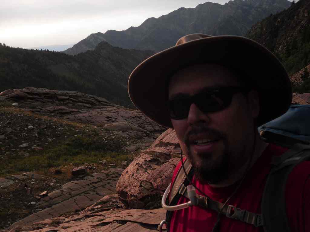
Here's a self-portrait sitting in the tent. With two jackets on. I would have been wearing a hat, but it was completely soaked. In fact it's still wet a day after getting home.
At around 8:00 I ventured over to my own tent and climbed inside. I left my soaked shoes in the vestibule hoping they'd be able to dry a little by morning. At least they wouldn't get rained on.

I pulled out some dry socks, long pants, and a warm cap and climbed into my sleeping bag. My feet were still freezing from the hike through the rain and mud. It took more than an hour before they felt warm enough to allow me to comfortably sleep.

When I sleep out in the mountains I like to wear ear plugs. Otherwise every noise seems so loud and even the slightest noise will wake me up. Apparently after we went to bed another group with horses set up camp a couple hundred feet from us. I didn't hear them at all. In the morning I looked out toward the lake and saw their horses and tents and was utterly confused.
We survived the night and discussed our plans for the rest of the trip. As I said, our original plan was to hike back 4 miles to the Naturalist Basin turn off and head a couple miles up to one of the lakes there. That would have been a 6-6.5 mile day, and left us about the same distance to get back to the car the next day. We also considered hiking to Scudder Lake which would have been 6-6.5 miles, but leaving us only 2 miles back to the car the next day.

We packed up camp still not sure what to do. We didn't want to spend another night out in the rain, soaked and unable to even see anything. We determined that if the skies cleared and we were able to dry out by the time we hit Scudder Lake we'd stay there, saving the Naturalist Basin for another trip.
The farther we hiked the harder the rain fell until about a mile before Scudder Lake. The rain stopped, but the skies still looked threatening. It wasn't enough to convince us to stay another night. By this point the idea of having dry feet was too tempting, so we continued past Scudder Lake and headed for the car.
The last couple miles were difficult. We had to gain about 400 feet to get back to the car, and we had already hiked over 15 miles in less than 24 hours. We were exhausted and still had heavy packs (we still had that extra day of food in them). About a half mile from the car we could hear cars driving on the road. That gave us the extra little push we needed to climb the last little bit.

We got in the car just as the rain worsened (it started up again about the time we heard the cars). We drove through multiple storms back to civilization and surprised our wives with an early return. I think they were happy we didn't push it another day.

In all, we hiked 17.25 miles in just over 24 hours with nearly 3300 feet of climbing. We saw numerous lakes, the lower half of a lot of mountains, 5 mountain goats, and tons of clouds. At least it wasn't buggy, and we didn't get sunburned. Now I'm just waiting for my prunes to turn back into toes.

Saturday, August 17, 2013

Lakes Florence, Blanche, and Lillian

In an attempt to get another night out in the woods under my belt I asked my neighbor Casey if he'd like to do a backpacking trip sometime. We both had this weekend free, and as it turned out the mountains were still there. There are always a lot of good places to hike here in Utah and we picked one of the best ones. 
We made it to the trail head by 4:45pm, a bit earlier than I thought we might, being a work day and all. There was one parking spot left (maybe two) when we got there and we pulled right in. It still amazes me how quick and easy it is to get up into the mountains here.

We took the Lake Blanche trail from the Mill B South parking area. The trail starts out on a steepish paved trail for about 1/4 mile, then the dirt trail branches off from the paved trail and gets even steeper. Our goal was to get to Lake Blanche with enough time to set up camp and cook dinner before the sun went down. The sunset in the valley is right around 8:30, but we knew we'd be losing light before that.
If you're unfamiliar with the Lake Blanche area, there are actually three lakes at the top of the trail: Blanche, Florence, and Lillian. Blanche is by far the most spectacular with Sundial Peak shooting 1500' up from the lake, but the other two are worth the climb even if Blanche wasn't there. The interesting thing with these three lakes is that you have to hike to the highest lake first, then hike down to the others. As a result, almost nobody goes past Lake Blanche. 
In the image above it looks like the last mile of the trail goes straight up the side of the mountain. That's not an illusion. It's steep. According to my GPS data, the trail averages a nearly 17% grade, with the last 3/4 of a mile averaging 23%. I like trails in the 10% range.
We made slow progress up the trail. It's a lot different to carry up an additional 25 pounds. Hopefully by next summer I can lose 25 pounds from my front to make it easier to carry 25 pounds on my back. It was also extremely hot. I doubt the temperature dipped below 90 the whole way up. We were dripping sweat by the time we arrived.
Despite all of our short rests, we made it to Lake Blanche by 7:00pm, making the trip 2.25 hours. I did it without a pack last year in 2. We were very impressed with ourselves for making the climb. According to the GPS, we hiked 3.4 miles (note the 2.8 miles on the sign above... liars) to the lake and climbed 2700 feet (they got that part right on the sign).

As soon as we made it to Lake Blanche we started looking for a good place to camp. Last year I had seen a few good spots up on the hill to the North of the lake, but none of them looked very good to me this year. Camping spots can look great until it comes to throwing down your pack and setting up camp. Thinking about sleeping there can really change your perspective.

Since we arrived so early we decided to keep looking. There were a couple places that would work up near Blanche, but nothing really jumped out at us. We followed the trail down near Lake Florence (the next one down) and found the most perfect camping spot I've ever seen.
We didn't even have to keep looking. It was perfect. There was a small grassy area--easily big enough for both of our tents, surrounded by large rocks with an amazing view down the canyon.
Shortly after we arrived the sun dipped below the ridge as we set up our tents.
Casey went down to the lake to pump some water so he'd have something to drink that night, and got water for his dinner. Not having a filter, I packed nearly 4 liters of water up the mountain (that's 8 pounds of water). In the above picture Casey's coming back up from the lake.
The above picture shows the little waterfall that comes down from Lake Blanche and fills Lake Florence. We got to listen to the sounds of the waterfall all night.
We both cooked Mountain House meals. By cooked I mean we boiled water and poured it into the bag and let it sit for 8-9 minutes. While the food was rehydrating we hiked over to some rocks overlooking the big dropoff into the canyon and we ate dinner there while the sky darkened.
After chatting for awhile under a bright moon we each went to our tents and went to sleep.

When you think of sleeping in the mountains, you think it'll be cold, right? It wasn't. It was hot all night. I think we both got a bit of sleep, though, and no bears came through camp, so that's a plus. In fact, there was hardly a sound, hardly a breeze, hardly a speck of light after the moon dropped below the horizon. It was extremely peaceful.
Around 7:00am I got out of bed and got dressed. The sun was starting to lighten the sky and I wanted to get some good pictures of the sunrise. I see the sunrise most days on my way to work lately, but I'm usually cursing it for shining in my eyes as I'm trying to drive East. This was one sunrise I could enjoy.
The above picture is looking to the North at the ridge between Millcreek and Big Cottonwood Canyons. The canyon in the bottom of the picture is what we walked up.
After eating some breakfast and taking down camp we each filtered some water so we'd have something to drink on the way down. We took a little side trip all the way down to Lake Lillian just to see it up close, and then climbed back up to Lake Blanche. There were already a couple dozen people at Lake Blanche (but only one group of really quiet people near Lake Lillian--like I said, few people ever go past Blanche). As we descended we ran into about 50 more people in various states of exhaustion. We talked to a few people a little more than just the customary, "Hey, how's it going?" People seemed excited that we had spent the night up there (but they seemed equally glad that they weren't carrying our packs).

It was a great, relaxing trip. Casey and I seem to have very compatible backpacking styles, and I love being able to pick his brain about backpacking; he has a lot more experience than I do.

In all, we hiked 7.8 miles and climbed over 3000' (2700' to Blanche, then another couple hundred to get back up to the main trail). For the year, I've hiked right near 58 miles, 20 of those with a full pack.